I was flying with a student recently working on VOR (Very High Frequency Omni Range) radio navigation. We tracked various magnetic courses sent by the VOR transmitter flying To and From the station and then intercepting other courses. We were monitoring the Madison Approach Control frequency as we were flying near their operation area. It was a “severe clear” day or as it is sometimes termed CAVU (Ceiling and Visibility Unlimited). Aviation loves its acronyms! Radio traffic was heavy as it was a weekend.
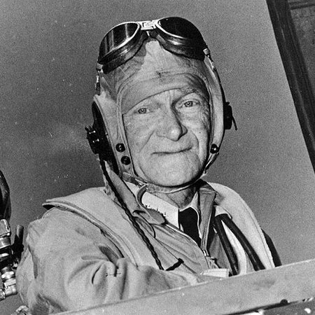
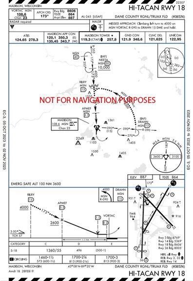
As our navigation practice continued, I heard an aircraft request a practice instrument approach procedure (IAP) into the Dane County Regional/Truax Field Airport (KMSN). The Cessna 172 requested the HI-TACAN RWY 18. This is a procedure normally used by military aircraft. Unusual, I thought, but it was later when the Cessna pilot reported back with the Approach controller that really caught my attention. The controller said, “Cessna NXXXXX, radar contact, climb and maintain 4,000, proceed direct to the Drahn intersection …”. Drahn? As in Pete Drahn, the former airport director at Madison, retired Wisconsin Air National Guard Pilot, and Wisconsin Aviation Hall of Fame inductee? I wondered if there is a relationship. What I didn’t know was that a few years back the FAA was looking for a name to call the holding fix for this approach. The 128th Fighter Wing Commander was contacted, and he suggested DRAHN. While the process is not as simple as that, DRAHN met all the Federal Aviation Administration (FAA) requirements for “Naming of NAVAIDS, Aeronautical Facilities, and Fixes” so it became the new name of the fix. Later, follow-up communication with Pete confirmed the specifics.
Flying for more than 50 years I have landed at, navigated to (or from), flown over (or by) and held (delayed) at many aids, facilities, and fixes around North America. Many of those had names of local origin, some obviously a salute to local aviators and others were, well, let’s just say, unique. While today’s instrument fixes are almost unpronounceable, many older names share an interesting, often untold story.
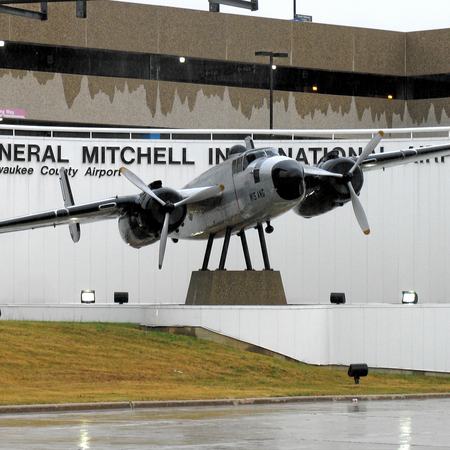
Let’s take a flight around Wisconsin and get an idea of names used for some of our airports. Of course, there is Mitchell International Airport, named for Billy Mitchell. The Green Bay/Austin Straubel International Airport is named for the local WWII aviator. Heading up to the Northwoods we find Lakeland/Nobel F Lee Memorial Field just northwest of Woodruff. Lee was the airport’s long-time FBO and airport manager. On Lake Superior we find Ashland’s John F Kennedy Memorial Airport. Turning southwest we head to the City of Rice Lake and its airport, Rice Lake Regional/Carl’s Field, named after longtime airport manager and weather observer Carl Rindlisbacher. Turning due east, we head to the Crandon/Steve Conway Municipal Airport. Steve was a B-17 pilot in WWII, and longtime airport manager. On our last leg we head southeast to the Oconto/Douglas Bake Municipal Airport. Doug was a local pilot and longtime airport commission member. Mitchell, Rindlisbacher, and Straubel are WAHF inductees.
Only one Wisconsin VOR station is named for other than its city location – Badger (BAE). No. It is not located in Madison but north of Waukesha. About half of the VORs once located in Wisconsin have been decommissioned as air navigation moves to a space-based platform. A ground-based backup navigation system, the Minimum Operational Network (MON), will be made up of only a few VORs and ILSs as the upgrade concludes.
The Locator Outer Marker (LOM) for the Oshkosh ILS Runway 36 is named Pober and Taxiway Papa (west of Runway 18/36) are salutes to Paul Poberezny. The RNAV (GPS) Runway 27 (IAP) into Oshkosh has PEENA as its Final Approach Fix. That is a tip of the cap to Federico Pena, the US DOT Secretary in office when RNAV IAPs began to be developed. The Green Bay procedures have several logical waypoint names – FAMIS, TNDRA, FAVRE, and LMMBO.
RNAV (GPS) Instrument Approach Procedures have popped up like dandelions in the spring. These new approaches have created the opportunity for new names and the process has created some real tongue twisters. Janesville’s RNAV (GPS) RWY 22 provides several examples – FORVO, WUTSI, and TEGGU. Wisconsin Rapids RNAV (GPS) RWY 20 has UHTIZ, LHALL, and AKAKE. We must admit “A Cake” is easier to pronounce than many but you get the idea. Enroute IFR fixes weren’t left out with names like – VIYUR (east of Eau Claire), FOMAG (near Wisconsin Dells), and PKRNA (southeast of La Crosse).
Then we have VFR Checkpoints. On the chart they appear as magenta pennants with the checkpoint’s name in black and underscored. These points help pilots provide ATC with locations known to the controllers. These are not limited to five letters. Recently created checkpoints, part of the arrival into AirVenture, are ENDEAVOR BRIDGE, PUCKAWAY LAKE, GREEN LAKE, RIPON, and FISK. VFR checkpoint names can still be a challenge to pronounce, especially if you are not from Wisconsin. SOBIESKI and LITTLE SUAMICO are easier than my favorite LAKE KOSHKONONG.
Do you have a favorite waypoint, NAVAID, intersection, fix or facility? If so, we would love for you to share it with us. Visit us on Facebook and leave a post and better yet an image of the fix on the appropriate chart.
The fine print
It should come as no surprise that the FAA has a procedure detailing the naming of these points, FAA Order JO7400.2P, Procedures for Handling Airspace Matters. The most recent edition dated April 20, 2023, is a whopping 420 pages long. It is Section 3, Naming of NAVAIDS, Aeronautical Facilities, and Fixes, that is of interest to us. Specifically, we will look at paragraph 3-3-3, Naming of NAVAIDS and paragraph 3-3-4, Naming of Waypoints, Intersections and DME Fixes.
A brief history of radio air navigation
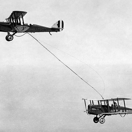
The first generation of radio navigation was the radio direction finding system. Originally a shipboard system, the aircraft version required a heavy receiver and was complicated to operate. Used primarily by the military it would reappear later for general aviation in a reinvented receiver.
Next was the low-frequency radio range, also known as the four-course radio range, LF/MF four-course range, or the A-N radio range. Pilots would fly an aural “beam” created by the overlapping of the Morse code for letters A and N. The on-course indication was a solid tone. This system was used beginning in the late 1920s for both long range navigation and instrument “let downs”. The last LF/MF transmitter in the United States was turned off in the 1970’s.
Non-directional beacons (NDB) were developed in the early 1930s. This system began as the radio direction finding system and like its predecessor consisted of two parts. The ground-based transmitter and the airborne receiver. Improvements to the receiver – lighter weight, a sense antenna, and the ability to electronically “rotate” the loop antenna created the Automatic Direction Finder (ADF). This system was also used for enroute navigation and instrument approaches. Today, very few enroute/approach NDBs exist. They are, however, still used as locators for ILS approaches.
Just prior to the outbreak of World War II a long-range navigation system was developed by both British and US firms. Called LORAN in the US and DECCA by the British, the concept was the same. It was used during the war and after but development for General Aviation ceased with the development of GPS.
The VOR, invented in the 1940s, became the standard radio navigation system in the 1950s. This VHF system had fewer interference issues and provided the pilot with 360 degrees of navigation with a visual on-course indication. There were over 4,000 VORs worldwide at one time. Today, the VOR system is being replaced by the Global Positioning System or GPS.